NYASA
game
|
|
NYASA game |
|
|
|
||
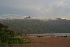
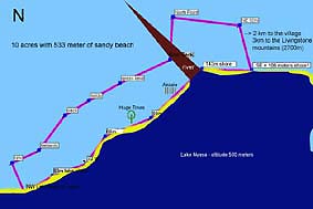
Here water sports, mountain climbing goes together with game watching. Over 500 meters of sandy beach are most attractive and potential for bigger commercial projects.
|
|
|||||||||||||||||||||||||||||
|
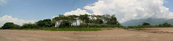
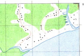
About one fifth of the property is separated by an estuary - can be seen on the right hand side of the photograph, while the bigger part is on westside of the river. The river bank and the lake beach front are protected by great acasias trees. |
|||||||||||||||||||||||||||||
|
|
|||||||||||||||||||||||||||||
 |
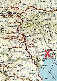
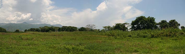
Getting to this paradise is worth a trip. Take your time while coming down from Mbeya, because this volcanic area has one of the most beautiful sceneries of the country to offer. The last 42 kilometers before you reach "Nyasa game" is gravel road with the great nature. |
||||||||||||||||||||||||||||
|
|
|||||||||||||||||||||||||||||
|
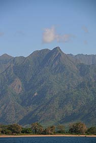
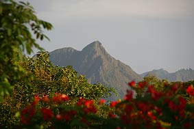
Who wants to go for mountain climbing does not have to go very far. The highest peaks of the Livingstone mountains are going up to 2600 meters and the mountains are only a few kilometers far away! About 70 kilometers North is the 2960 meters high Mountain Rungwe. This great central volcano is surrounded by 100 square kilometers of primary forest! |
|
||||||||||||||||||||||||||||
|
|
|||||||||||||||||||||||||||||
|
Both sides of the estuary belong to the property. Where the river flows into the lake is the best and easiest way to cross by car or by foot. Crocodiles and Hippos are not a matter of every day, but at night the visitor is advised to stay away from the river bank if he is not accompanied by a local person. This estuary of the property is safe, but the other river mouth which is 1 kilometer westwards situated, has regular game activities. |
|||||||||||||||||||||||||||||
|
|
|||||||||||||||||||||||||||||
|
|
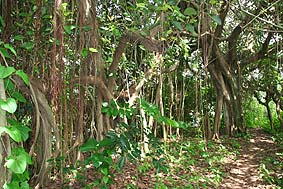
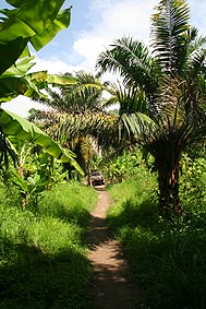
Parts of the gallery forest at the river are forming dense vegetation which is by far not easy to penetrate. Small paths are leading through this forest as well as through the preceding beach vegetation - a paradise for ornithologists. |
||||||||||||||||||||||||||||
|
|
|||||||||||||||||||||||||||||
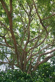
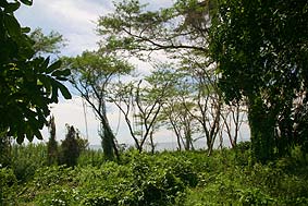
| Much light is penetrating through acasia trees hence they are offering a good view from the interior to the lake. |
 |
||||||||||||||||||||||||||||
|
|
|||||||||||||||||||||||||||||
|
|
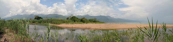
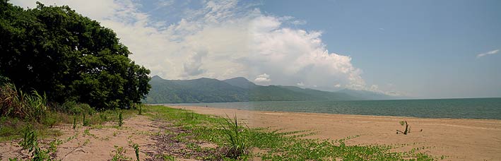
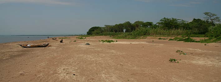
The picture shows the wide beach on the eastern part of the property with the Livingstone Mountains on the back. On the foot of the mountains by the lake are a couples of settlements - this is good because of the fresh food supply and other necessities. |
||||||||||||||||||||||||||||
|
|
|||||||||||||||||||||||||||||
|
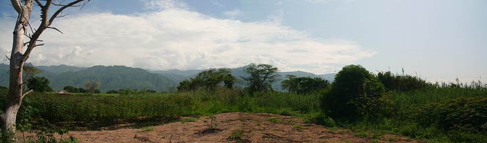
View from the Southeast part of the property towards the East. The owner allowed using part of the property for cultivation of cassava and bananas, because of its fertile soil and high productivity. Even in the dry season the rain remains sufficient for most of the crops. The property can be developed as a commercial in hotel or lodge as soon as the interested buyer is found and project construction can start immediately. |
|||||||||||||||||||||||||||||
|
|
|||||||||||||||||||||||||||||
|
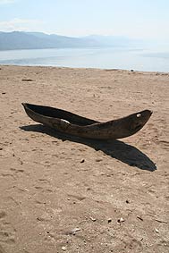
Fish, fishermen and fishing boats are available. Buy fresh fish from them or go on a boats tour with them, because while snorkeling you will see plenty of the 320 counted different species of colorful fish, but unfortunately no corals.
|
|
||||||||||||||||||||||||||||
|
|
|||||||||||||||||||||||||||||
 |
24°C temperature is the water by average and it is so clear that you can see up to 20 meters deep into the lake. Do not forget your snorkeling glasses. |
||||||||||||||||||||||||||||
|
|
|||||||||||||||||||||||||||||
|
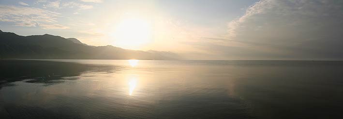
On a North-South length of 500 kilometers and an average width of only 50 kilometers the lake is connecting 3 countries, Tanzania, Malawi and Mozambique. Lake Nyasa is the third biggest in Africa and part of the southern Rift Valley which means the lake is 700 meters deep while the surface has an altitude of about 475 meters above the sea level - more than 200 meters are going down on the bottom of the Rift Valley! |
|||||||||||||||||||||||||||||
|
|
|||||||||||||||||||||||||||||
|
Huge trees are protecting the frontline of the lake. The giant umbrella of these trees makes the construction of sun shades useless. |
|
||||||||||||||||||||||||||||
|
|
|||||||||||||||||||||||||||||
|
|
Nevertheless everyone
should keep in mind that this area is virgin land and even no tour operator
is targeting this area which means that every entrepreneur can
achieve a maximum of success, but he has to take care of the basic needs of
infrastructure. |
||||||||||||||||||||||||||||
|
|
|||||||||||||||||||||||||||||
|
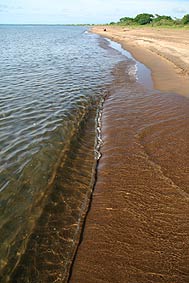
Pictured from the middle of the property towards East. The level of the lake only differs a couple of centimeter from dry to raining season which means that the sandy beach always remains broad and easily passable by car. Here is no tide, no sea grass and no corrosion due to salty sea water and therefore no showering or flashing after swimming is necessary! |
|||||||||||||||||||||||||||||
|
|
|||||||||||||||||||||||||||||
|
Have enough time when you are going to visit this terrific, but unfortunately forgotten, Eldorado of Tanzania. It is about 150 kilometers Southeast from Mbeya from which the last 42 kilometers are off-road. All further information's can be obtained by application.
|
|
||||||||||||||||||||||||||||
|
|
|||||||||||||||||||||||||||||
|
|
Only a few settlements
are situated in the back of the property, that is why this long beach from
west- and eastwards of the
river remains untouched as it was many centuries ago. |
||||||||||||||||||||||||||||
|
|
|||||||||||||||||||||||||||||
|
Click on GPS site plan to see the full dimensions of the chunk of sweet water sandy beach! |
|
||||||||||||||||||||||||||||
|
|
|||||||||||||||||||||||||||||
|
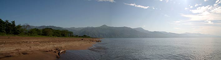
Standing on the Southeast beach corner looking west. At the horizon on the very left side of the photograph is where the Tanzania ends and Malawi starts. |
|||||||||||||||||||||||||||||
|
|
|||||||||||||||||||||||||||||
|
Evergreen, fertile and lush grows the vegetation on this part of Lake Nyasa. Behind the huge trees follows immediately the sandy beach. |
|||||||||||||||||||||||||||||
|
|
|||||||||||||||||||||||||||||
|
|||||||||||||||||||||||||||||
|
|
|||||||||||||||||||||||||||||
|
P. O. Box 105 200 Dar es Salaam/Tanzania
|
|||||||||||||||||||||||||||||